Saúdská Arábie
stát v jihozápadní Asii
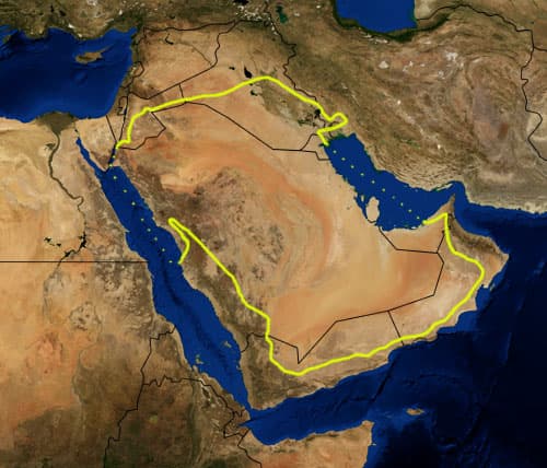
This is a map showing the location of the Arabian Desert. The yellow line encloses ecoregions as delineated by the World Wide Fund for Nature: the "Arabian Desert and East Sahero-Arabian xeric shrublands", and the "Arabian Gulf desert and semi-desert" (a narrow strip along the Persian Gulf coast), and the "Red Sea Nubo-Sindian tropical desert and semi-desert" (along the Red Sea and in patches throughout the Arabian peninsula). National boundaries are shown in black. I, Pfly, made it using NASA Blue Marble imagery and ecoregion GIS data which I simplified and digitized in Photoshop. WWF code PA1303
Autor: Pfly. Credit: NASA, plus my additions by myself.. Licence: Public domain.
- Typ
- stát
- Platnost
- od 1. 1. 1727, otevřená platnost
- Záznam
- #550
Vazby, důkazy a zdroje
Kliknutím na souseda otevřeš jeho vlastní kartu. U vazby je vidět typ, směr, časová platnost a její doložení.
Kam dál
Zatím bez vazeb v publikaci.
Důkazy
Tato entita zatím nemá doložená tvrzení.
Připravujeme uzly a hrany pro vizuální mapu entity. Jakmile data dorazí, graf se rozsvítí přímo tady.